 |
 |
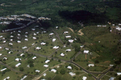
| Caripito from the air circa 1950's |
Caripito from the air circa 1950's |
 |
 |
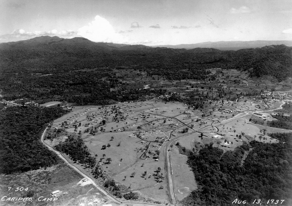
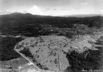
| This one is from 1937. I can see the
house we lived at in 1949, but the camp had changed by then. There is no
school house built yet in this photo. The clearing at the lower
left corner is the start of the large hospital that would be built there
- Houston Floyd. |
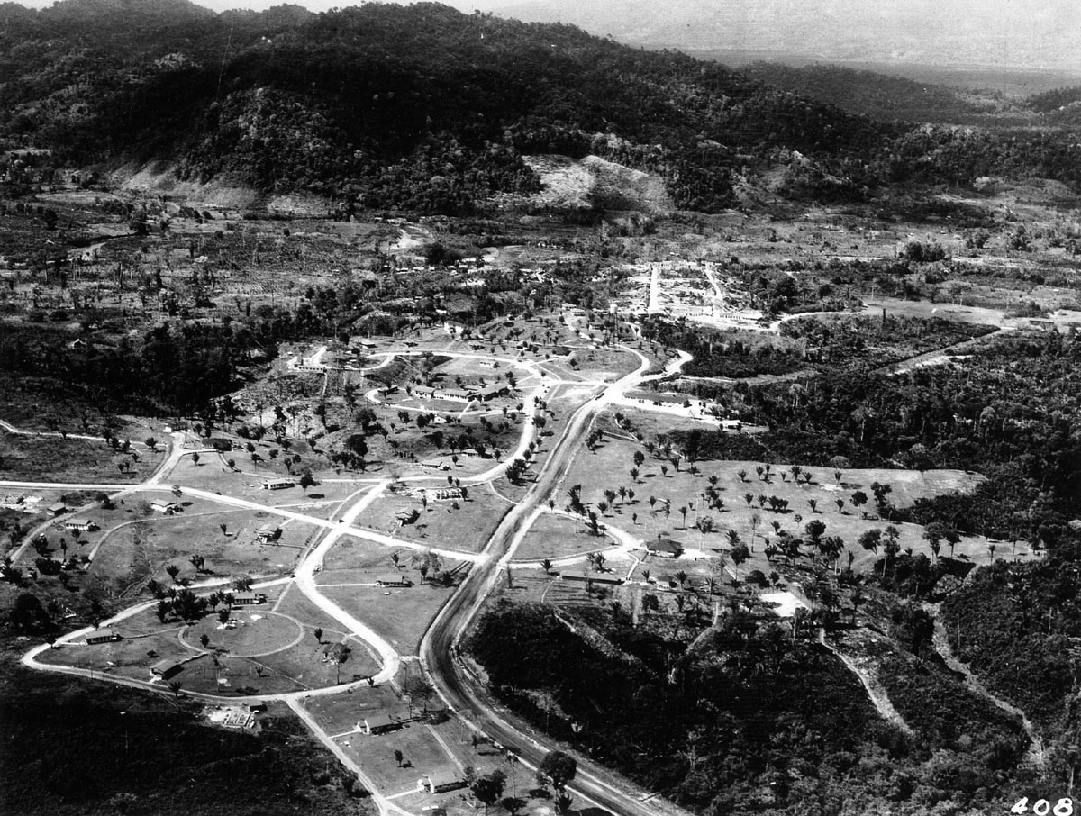
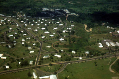
This picture is taken from the same
angle as the one on the left, but is at a lower altitude. It was taken
before the other one. Probably around 1930-1935. The School was
eventually built in the middle of the circle in the lower left. The
clubhouse is on the right with the semi-circle drive in front.
There is no swimming pool yet, but you can see the swimming pool beside
the clubhouse in the picture on the left. You can see the white
tennis court and the bowling alley (the long low building) -
Houston Floyd. |
 |
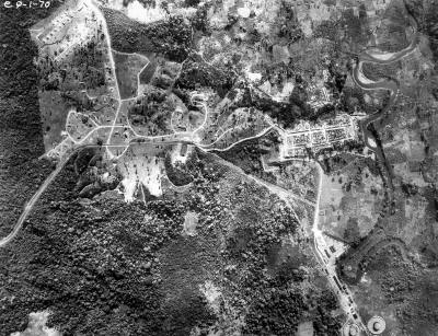 |
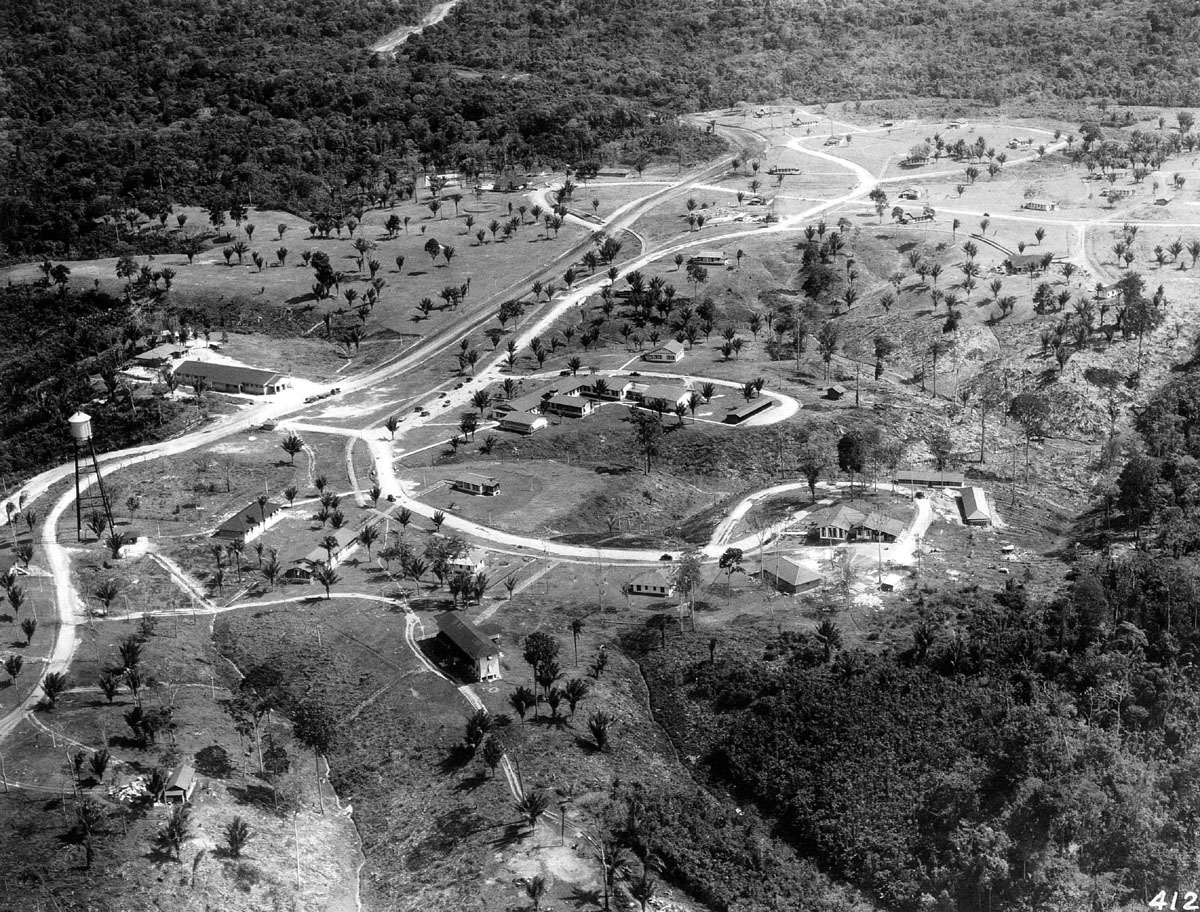
| The cluster of buildings in the middle
is the District Office. The building on the lower right side with the
road around it is the Mess Hall. The long two story building in the
lower middle is the Bunk House for the single men. There is a good
picture of this building in Caripito
Gallery 2 submitted by Doug Becker. The Commissary is the long
building on the middle left side. The clubhouse is in the upper middle.
In the middle upper portion, you can see that he clearing for Hospital
Hill had not started. In the upper left, you can see the road to
Quiriquire (about 25 km away) - Houston Floyd. |
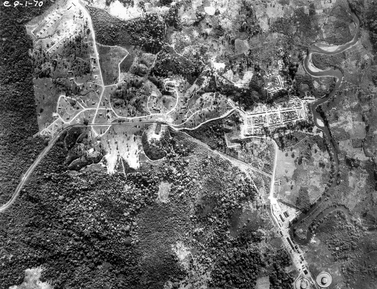
This is a high altitude picture taken
straight down over the entire camp and village area. You can see the
Caribe River flowing on the right side and the start of the tank farm in
the lower right. That road leads on down to the docks on the San Juan
River. The Caribe River flows in to the San Juan. Caripito village is
that cluster of buildings in the center right that backs up to the
Caribe River - Houston Floyd. |