|
| |
Home
 Ondas del Lago
Contributed Content
Doug
Becker
Ondas del Lago
Contributed Content
Doug
Becker
The photos and items on this page come to us courtesy of Douglas Becker, now
sadly deceased. I consider them be significant because of their historical
reference that allows many of us who lived in Venezuela to see what life was
like there prior to our arrival, with those who came before us. To others who
may have lived there during the years portrayed here, this section will
hopefully be a nostalgic trip back in time to younger years of your life.
The Becker family years in Venezuela were quite extensive, including 3 years
in Jusepín (1946-1949), 4 years in Maracaibo (1949 - 1953), 6 months in Caripito
(Jan 1953-Jun/Jul 1953), 2 years in Quiriquire (1953-1955), and 6 additional
years in Maracaibo (1955-1961). In the process, Doug attended EBV from
kindergarden through the first half of the 3rd grade, and again from the 6th
through the 8th grades. Doug graduated from EBV in 1958 and attended high school
in the States.
Doug's father, Leroy, was a paleontologist for Creole for 20 years starting
in 1941, finally retiring in 1961. Leroy passed away in 1999. Doug has a
brother, Kenny, and a sister, Kathy (also known as “ChiChi“ to her friends); his
mother, Ruth, passed away in 2003.
We're all indebted to Doug for sharing this part of EBV and Maracaibo's
history with us, for his hard work in putting all of these photos and items
together, and finally, for transmitting all of this information to me for
inclusion into this website to allow all of us to share.
 |
 |
 |
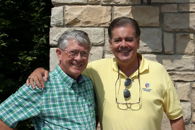
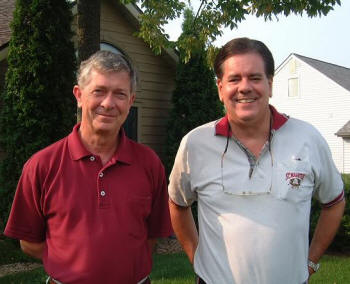
| Doug & I taken during his visit to
Fort Wayne in September, 2004 |
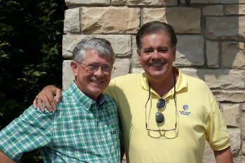
Doug & I taken during his visit to
Fort Wayne in September, 2007 |
Doug & I taken during his visit to
Fort Wayne in September, 2009 |
|
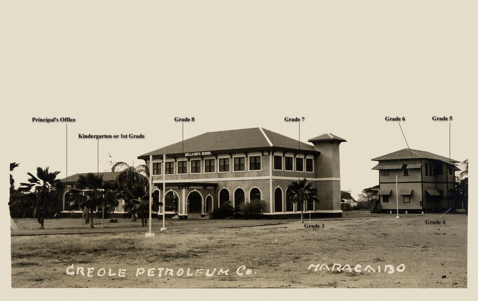
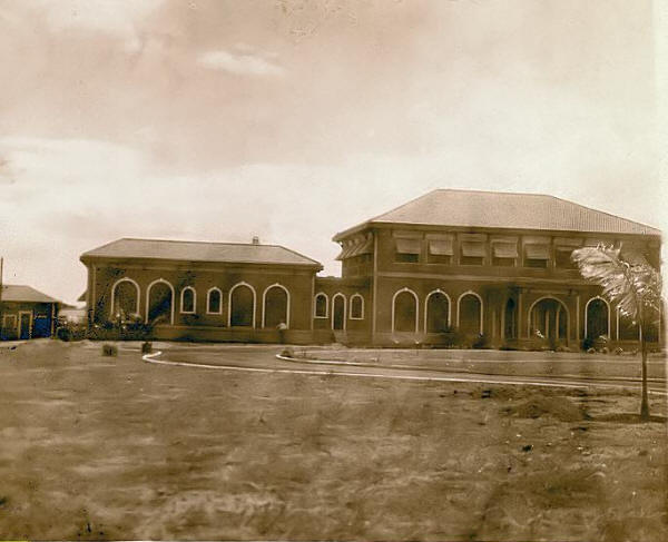
The First Original EBV School
Building

This extremely rare photograph was sent to me by Doug after it was
originally provided to him by Frank Schleicher. It's the only photograph
of this building that I'm aware of. As such, it's an important
photograph as far as the history of EBV is concerned.
It's taken Doug quite a long time to finally piece together the story
of the photo from numerous individuals and, thanks to these
contributors, it can finally be posted here. I'll let the statements
from the contributing individuals themselves tell the story:
| Oster Bayne,
with comments from his father's memoirs in italics: |
“The Lago Petroleum Corporation built a
mansion of a home in Bella Vista, quite near to where their head
office and camp were located, for the President of the company
at that time, Mr. Stewart. However, the building was never used
as a home and was converted into a hospital soon after its
construction around 1925/6. On conversion from a home to a
hospital it too was well furnished with modern equipment,
operating theatre and furniture. The ex-President's home,
converted into a Lago hospital, was later again converted into a
joint oilfield companies school house and named The Bella Vista
School especially for the children of foreign employees of the
oil companies (except Shell where the school system was based on
the English system). Classes were always in English but Spanish
was taught and many national children did attend this school to
learn English, both employee's children and subsequently those
from the city.” “It was located on the current EBV site.
If I am right I think the new EBV buildings you knew were built
behind the two-story school buildings in the photograph. I also
think Frank Schleicher's Dad was involved or responsible for the
design and or building of the new EBV about 1949.” |
| |
|
| Fran McCammon San
Miguel: |
“Yes, that is indeed the school. My father has
almost the same exact picture. We used to play in the ground in
front made by the circle of the road, and just about to the
right of where the photographer was standing there was a tree
that was perfect for climbing by the non-adventurous.” |
| |
|
| Frank Schleicher: |
“My father was partially responsible for the
design of the new school, and did the design for the gym. Dad
was on the school board for many years, I remember visiting the
homes of teachers and principals that were being considered on
various trips to the states. I believe that my father built the
sound system that was used by the music classes and many
of the theater productions that were put on.
“I don’t know much about the history of the 2-story upper
school building. The older building shown was torn down about
1949. I remember sitting on the back steps of the new 'A' shaped
building and watching the building come down. The attic was
almost completely filled with a bee's nest. They gave many of us
kids jars of honey and honeycomb. The Kindergarten was to the
right of the old building as you faced the front. I went to the
kindergarten, but never went to any classes in the old building
pictured. An open air gym, with shop and dressing rooms, was
built shortly after the old school came down. My brother was
born in 1948 and I remember being picked up in front of the new
'A' shaped building the day he was born.” |

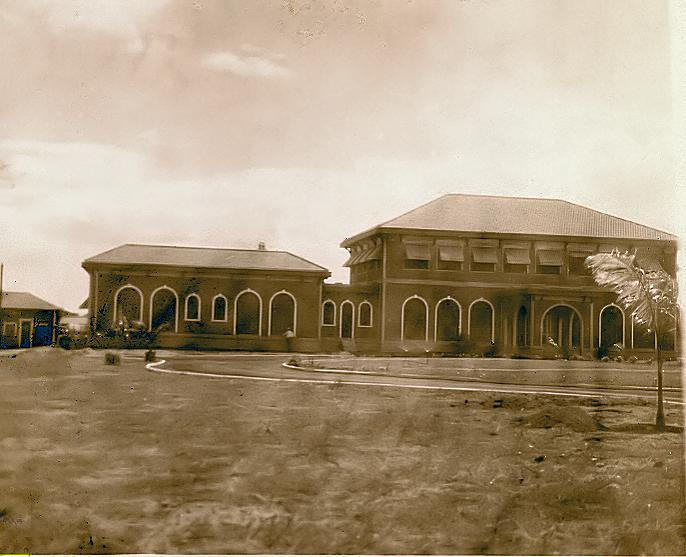
16 APR 2005: Although the above photo was not provided by Doug
Becker, I thought this would be the most appropriate location in which
to place it as it's another photo of the old EBV school building shown
above, but taken from a different angle. Amazingly enough, I happened to
find it on eBay.
There is no indication of a date anywhere on the back side of the
postcard, so I can only assume from the fact that it looks so much like
the photo above that the time frame is the same. In fact, it almost
appears to have been taken the same time as the above photo - perhaps
even on the same day. But we'll never really know.
2 DEC 2005: Doug Becker has just provided this historically-significant
photo of EBV before it became EBV. It was recently obtained by Doug from
Fran (McCammon) San Miguel during a visit he made to Vero Beach, FL
earlier this month. Fran and her husband Sam reside in a condo there.
Fran attended EBV from 1940-1946 (K-6th grade). This particular photo is
from one of her Dad's photo albums and is entitled “Lago Petroleum
Hospital, 1928”. So this is entirely consistent with Oster Bayne's input
above. This photo is mentioned in Fran's earlier comments
above. With this photo, Doug has managed to come up with the
earliest-known photo of this building yet discovered. Undoubtedly there
are more photos like this buried away in people's photo albums. But the
trick is to make people aware of the importance of photos like these and
to get them to contribute them for posting and sharing here.
The question remains: What was the exact date that the hospital became a
school? This question remains unanswered to date, and is a reminder to
all of us how easily history can disappear into the past unless it's
documented and safely archived. It really was quite a large complex and
considerable in size for Maracaibo as well. The dates of its
construction and conversion to a hospital, then to a school, would have
been milestone dates within the American community back then....yet
those dates have disappeared in time.
|
|
Alturitas Oil Field
Once The Deepest Well In The World
| |
 |
|
| |
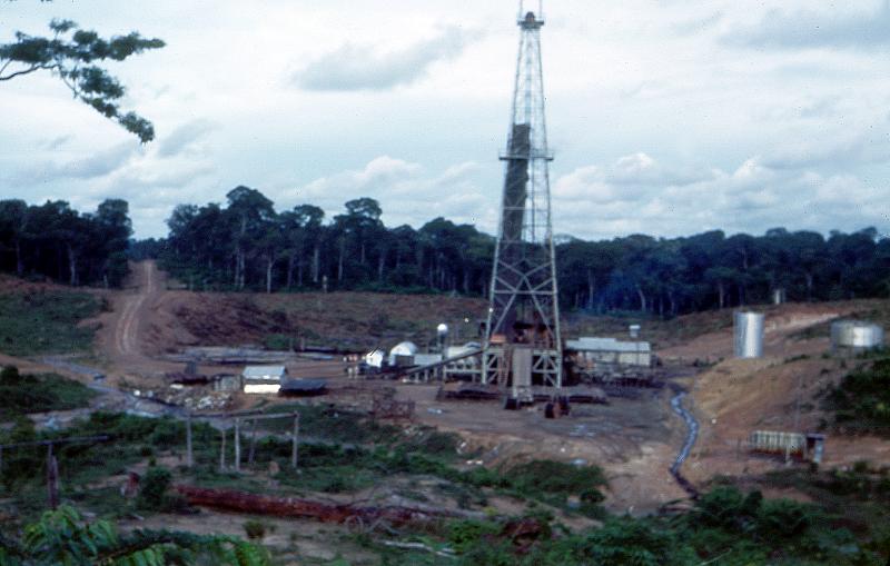
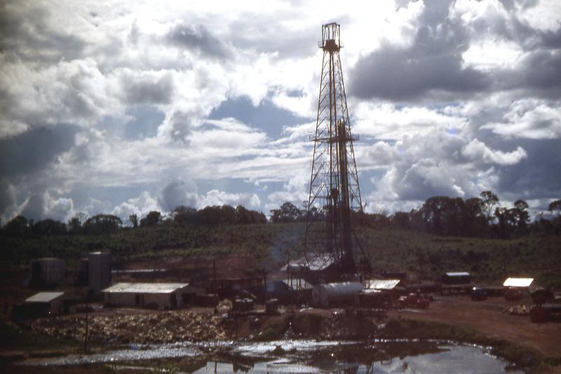
Alturitas #1 - “Picture was taken
by my Dad on 10 September 1949. According to Phil Wolcott, a
fellow Creole geologist of my Dad's, Alturitas #1 was drilled in
by Creole in 1949 and, at 17,033 feet, was the deepest well in
the world at the time. It was capable of producing several
hundred barrels of light crude oil per day; however, this was
considered uneconomical, and so the well was capped in. Phil
also said that Alturitas #1 was essentially a 24/7 operation and
that the off-duty crews probably lived in Machiques, the closest
real town of any size. He also mentioned that the well site
perimeter was expanded to reduce the possibility of Motilone
arrows from reaching the working crews.”
|
|
| |
 |
|
| |
Alturitas #1 - “Photo was taken
in 1950. If you compare this shot with the picture taken in
1949, you can see how far back the jungle had been cleared from
the well site.”
|
|
| |
 |
|
| |
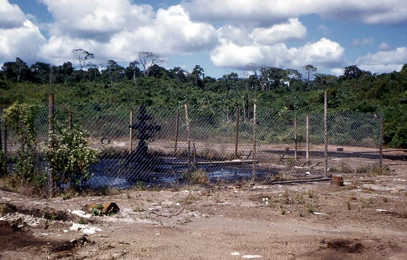
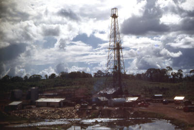
Alturitas #1 - “Photo was taken in late December
1952. The well has now been capped in. The capping device, also
known as a 'Christmas tree', can be seen in the center of the
fenced in area. Notice how the jungle has crept back almost to
the original well site.”
|
|
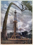
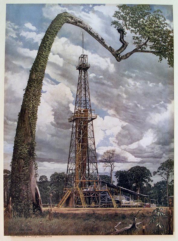
(Compare the next two photos below with a painting of
Alturitas #2 by Texas artist & illustrator Bob Wygant,
provided earlier by Steve Sleightholm, one of a series of paintings
commissioned by CREOLE in the early '50's:

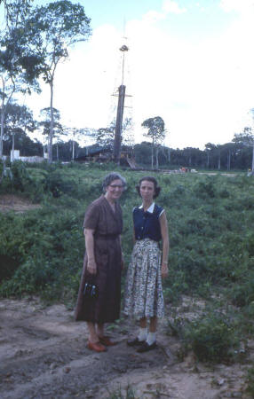
Alturitas #2 - “Late December 1952. This well was
drilled by Creole near the village of Alturitas, which was about 120
kilometers southwest of Maracaibo. The driving distance was closer to
200 kilometers. In those days, Alturitas was the 'end of the line' -
nothing between it and the Colombian border, only 50 kilometers away,
except the Rio Negro, jungle, and Motilones. The closest town was
Machiques, which was connected with Alturitas by a 30 kilometer gravel
road.”
In the photo on the right, the lady on the right is
Doug's mother and the lady on the left is his aunt who was visiting from
the States. |
|
Alquitrana Oil Field
Site of the First Oil Well In Venezuela
| |
 |
 |
|
| |
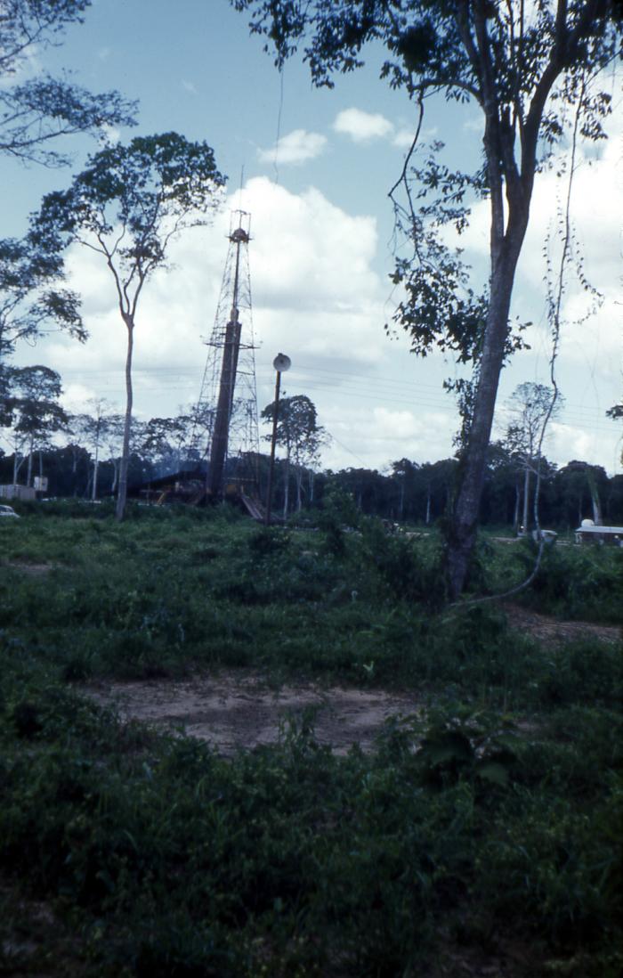
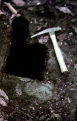
Andes Field Trip - 27 January 1951
“These photos were taken by my Dad while he was on a field trip
with a fellow Creole geologist, Phil Wolcott. The original 35mm
slide has deteriorated, hence the poor quality. However, you can
make out the hole in the ground, the 'well', and a can of oil
near the tip of the pick hammer.
“In 1878 a concession was issued to a Manuel Pulido, who with
some others formed a company called Petrolera de Táchira.
(At that time the law was that the government owned all
subsurface mineral rights.) The company dug the well, which was
only 30 or 40 feet deep, and extracted the oil by lowering a
bucket into the hole. Production was about one to two barrels a
day of crude oil that was refined mainly into kerosene for
lamps. Later, in the early 1900s, some of the oil was refined
into gasoline for the one or two cars that started to show up in
Táchira.” |
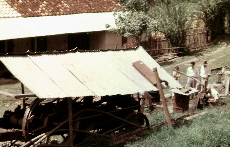
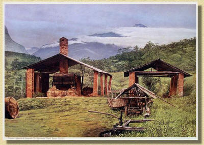
Andes Field Trip - 27 January 1951
“This is the refinery at Alquitrana, which is a
small village in the state of Táchira.
“The oil from the well on the
previous slide was refined here. I don’t know if it was still in
operation in 1951.” |
|
| |
 |
 |
|
| |
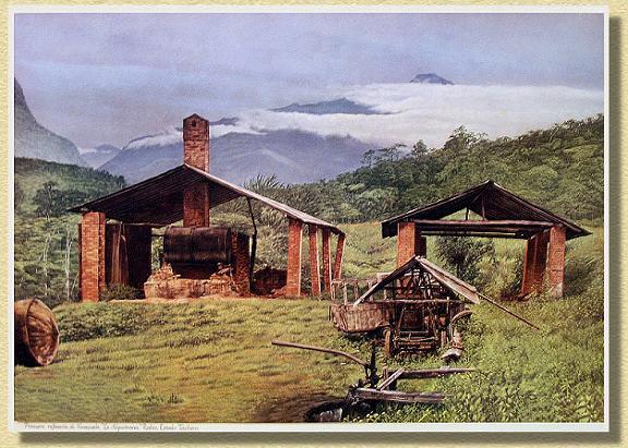
Andes Field Trip - 27 January 1951
“Another view of the Alquitrana Field.” |
Compare this painting by Texas
artist & illustrator Bob Wygant to the photo above it. This
photo really makes the painting come alive. |
|
| |
 |
 |
|
| |
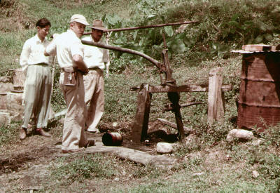
Andes Field Trip - 27 January 1951
“It appears that a pump was later used to bring
the oil to the surface, replacing the bucket. The man in the
baseball cap is Phil Wolcott.” |
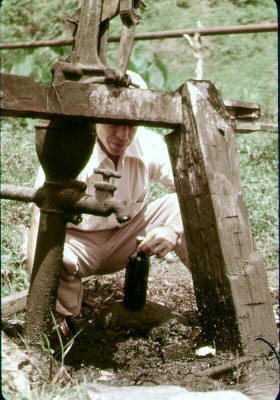
Andes Field Trip - 27 January 1951
“A closer look at the pump - Phil Wolcott appears
to be holding a bottle with an oil sample.” |
|
|
|
Visual History of the Club Movie
Screen (“The Big Screen”)
The photos in this series show the gradual evolution of “The Big
Screen” at the club, where many of us spent so much time through the
years. It's interesting to see how it started as a smaller screen for a
relatively small club membership, then grew larger and moved as club
membership increased in size.
Each of these screens, at one time or another, gave each of us many
hours of enjoyment as we watched movies and socialized under the open
skies and soft tropical evening breezes of Maracaibo over the years that
we lived there.
Comments appearing in quotations are Doug's.
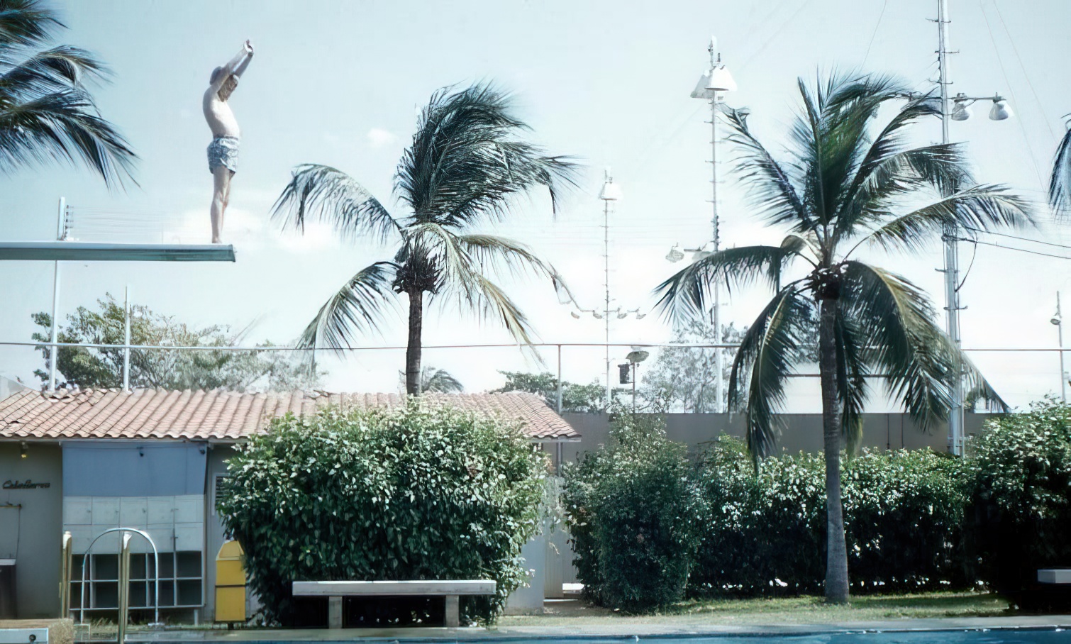
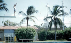
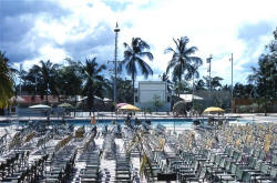
Doug writes, “I came across this photo recently. It
shows the fence being built around the Creole pool in Maracaibo - that
would date the picture as being between April and December 1950. You can
see the high diving board in the background, which means you are looking
from the southwest to the northeast. What you are seeing, I believe, is
the main gate being built. My old house, Casa 19, is behind the diving
board (though not visible). I wonder if anyone else has photos of the
fence being built?”
| |
 |
 |
 |
|
| |
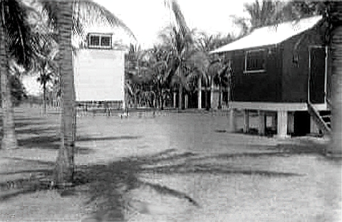
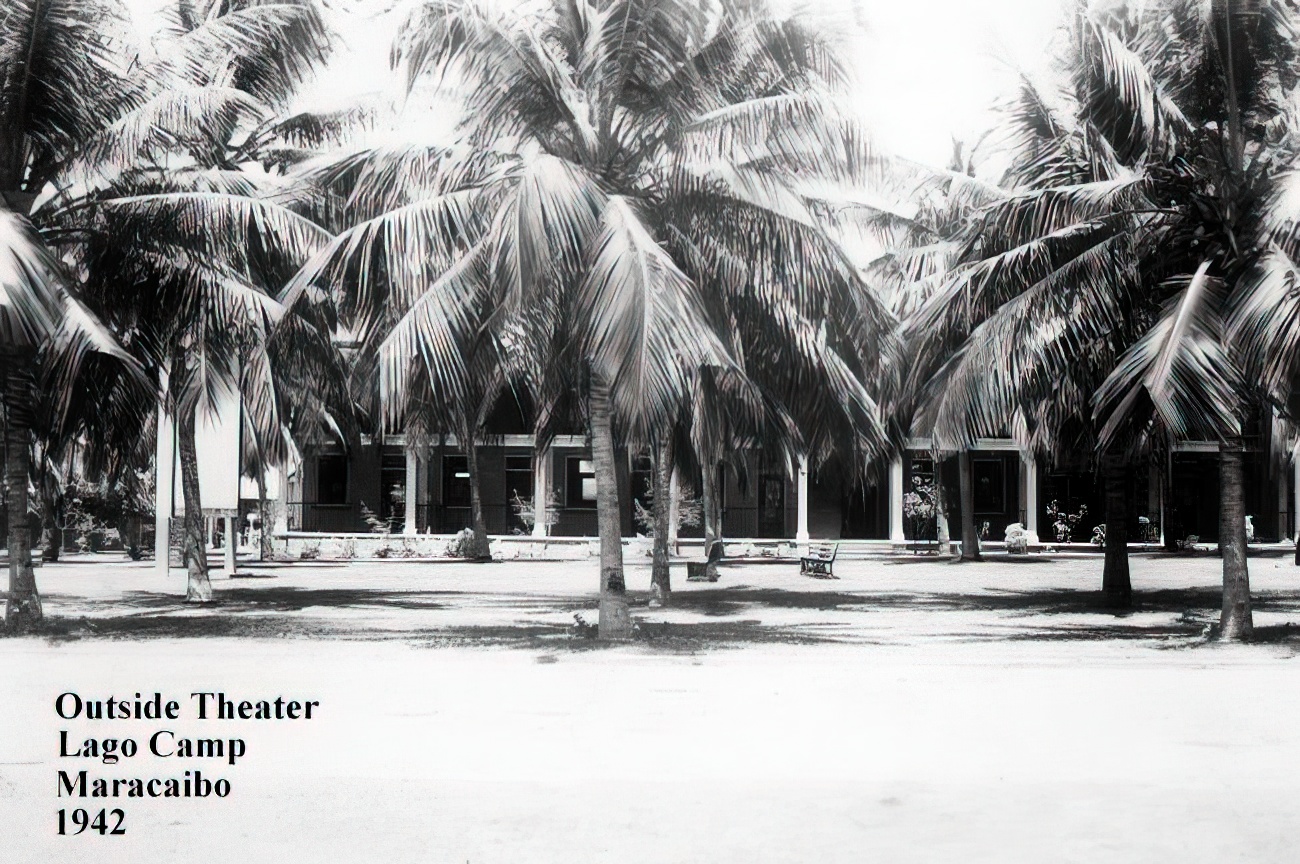
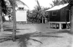
This
photo comes to us through Doug courtesy of Skid Frothingham.
“The outdoor theater is in the upper left. It's a good front
view of the screen, which is located just to the north of the
bachelor quarters and to the south of the pool. The photo was
taken sometime between 1938 and 1940. |
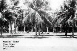
“This
was a picture taken by my Dad in 1942. (It) shows the same
outdoor theater as the previous picture only this is a side view
with one of the bachelor quarters in the background.” |
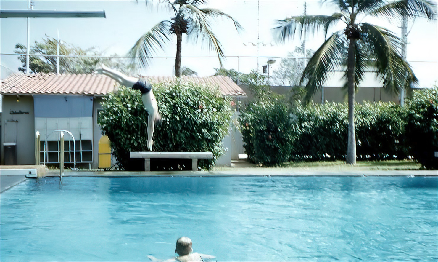
“In
this photo, taken in 1955, you can see the top of the screen,
built of concrete, on the right behind the palm tree. This is
where the tennis courts were. A canvas was attached to the fence
so that people couldn't sneak views of the movie, especially on
Monday nights, which was 'No Apta' night” (later changed to
Tuesday nights-CC). “On the left is the small building used for
changing clothes -'Caballeros' is on the left side.” |
|
| |
 |
 |
 |
|
| |
Another shot taken in 1955 showing the top of the screen on the
right behind the palm tree. |
“Taken in April 1957. Behind the girl, who is my sister, you can
see the projection booth for the outdoor theater. This building
was used later as the barber shop. Note that the cover over the
baby pool is now gone.” |
This
photo was “...taken in June 1961. Good view of the old screen on
the tennis courts. Note that the canvas on the fence has been
taken down and that the projection booth is now gone” because
the old screen was no longer being used. |
|
| |
 |
 |
 |
|
| |
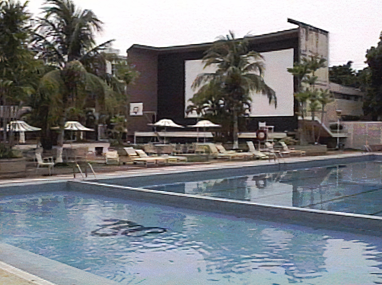
“This
photo was taken in 1961 and it shows the new screen...I believe
it was built in 1957.” |
This
is a shot I took shown earlier on the HOME page taken in 1995,
and shows the screen with “wing” extensions on either side.
While I'm not sure of the purpose of the wings, they may have
been built to limit the viewing angle, or to stabilize the large
structure, to possibly cut down on extraneous light, or perhaps
to prevent the screen from waving slightly with the breeze. |
This
last photo, taken in the late 1990's and sent in by Marcos Salom,
shows the bracing construction of the screen side extensions, as
well as the overall curvature of the screen, quite clearly. The
evolution of the screen is complete. |
|
|
|
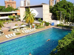
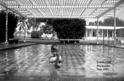
Vintage Creole Club Photos
Through the years, the Creole Club has undergone a
number of name changes as the years have gone by. First it was known as
the Lago Colony Club, then it became the Creole Club, and
now it's called the Lago Maracaibo Club.
No matter what name you remember it by, it was always
the premier place for all of us to visit, socialize, share companionship
with friends and acquaintances, and movie-watch during the years we
lived there. It's undergone many changes through the years, and members
have come and gone during their time in Maracaibo. But today it's still
going strong, and it still fulfills that same wonderful mission of
bringing everyone together in one place to share good times and
memorable events.
These photos show the club over a 19-year time span
from 1942 until 1961, and having them here makes it interesting to
compare to memories of the club we have during the years we lived there.
| |
 |
 |
 |
|
| |
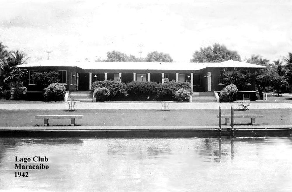
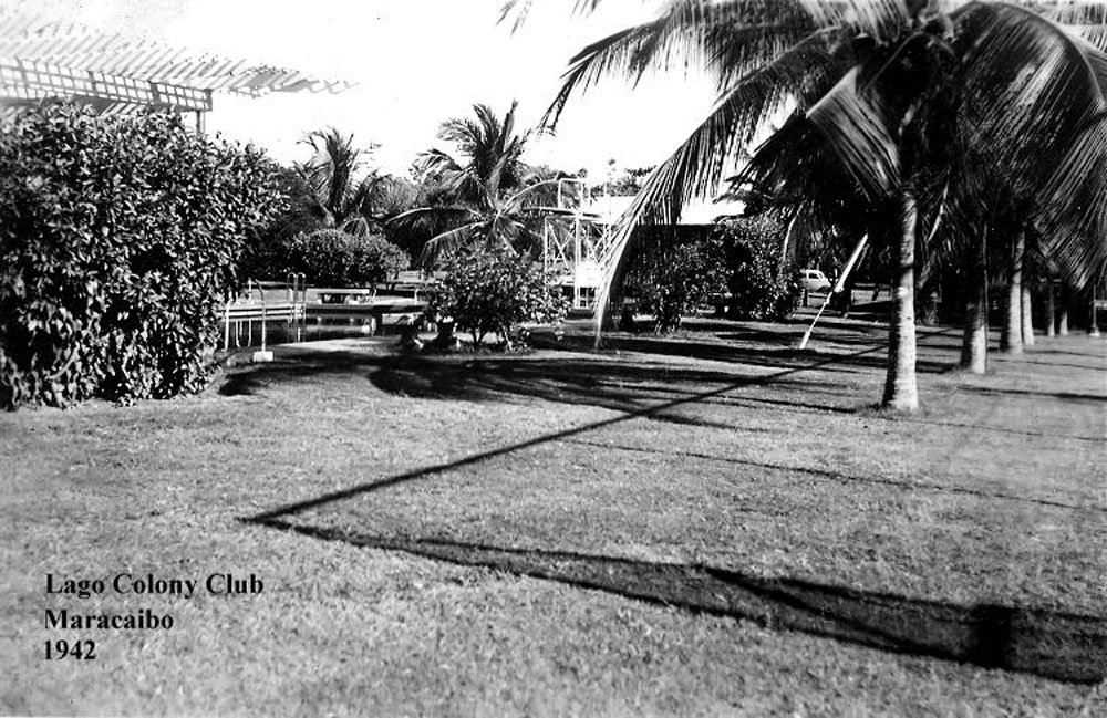
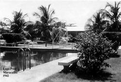
This
is a shot of the main clubhouse taken in 1942. |
Another photo taken in 1942, this shows the pool area years
before concrete pads were poured around it forming the pool
area. |
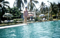
Another view of the pool showing the old high diving board that
was there for years. I know it was still there in 1968 when I
finally left Maracaibo, but has since been taken down. |
|
| |
 |
 |
 |
|
| |
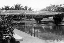
Notice the attractive trellis that used to cover the shallow end
of the pool, also known as the “baby pool”. It was still there
in Dec. 1951, as can be seen in the photo below. I don't know
how many years it lasted, but in general, a trellis like this
can be difficult to maintain over the long-term, so it isn't
surprising that it, too, disappeared over the years. |
View
of a sundial that used to be located by the shallow end of the
pool, also taken in 1942. |
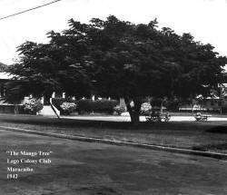
This
is “The Mango Tree” that all of us used to sit under while
watching the movies on the newer “Big Screen”. Even in 1942, it
was a large, expansive tree! |
|
| |
 |
 |
 |
|
| |
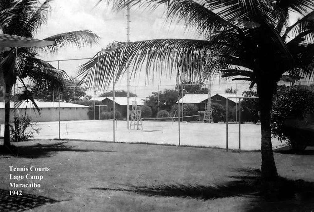
This
is a good view of the tennis courts as they appeared in 1942.
Because there was no concrete wall around the club at that time,
those living in the houses immediately behind the courts could
watch the players from their patios. |
An
excellent shot of the “baby pool” with the overhead trellis,
taken in December, 1951. “The Mango Tree” is in the background
behind the bush. |
This
is a great shot of the clubhouse taken in December, 1951, all
decorated for Christmas with the large Santa on the roof. Note
the wide, grassy expanse between the clubhouse and the pool in
those days. |
|
| |
 |
 |
|
|
| |
The
same shot taken from a different angle, with the clubhouse Santa
framed through the framework of the high dive. |
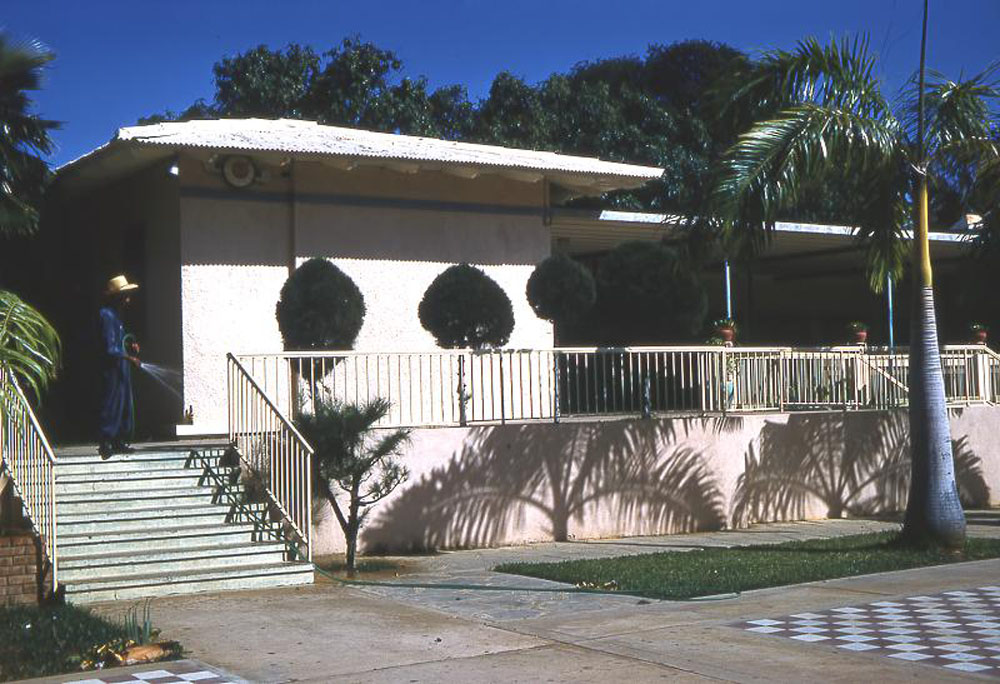
This
is a color view of the clubhouse taken in 1961.The structure
didn't drastically change too much in the next 7 years or so
from the way it appears here. |
|
|
|
|
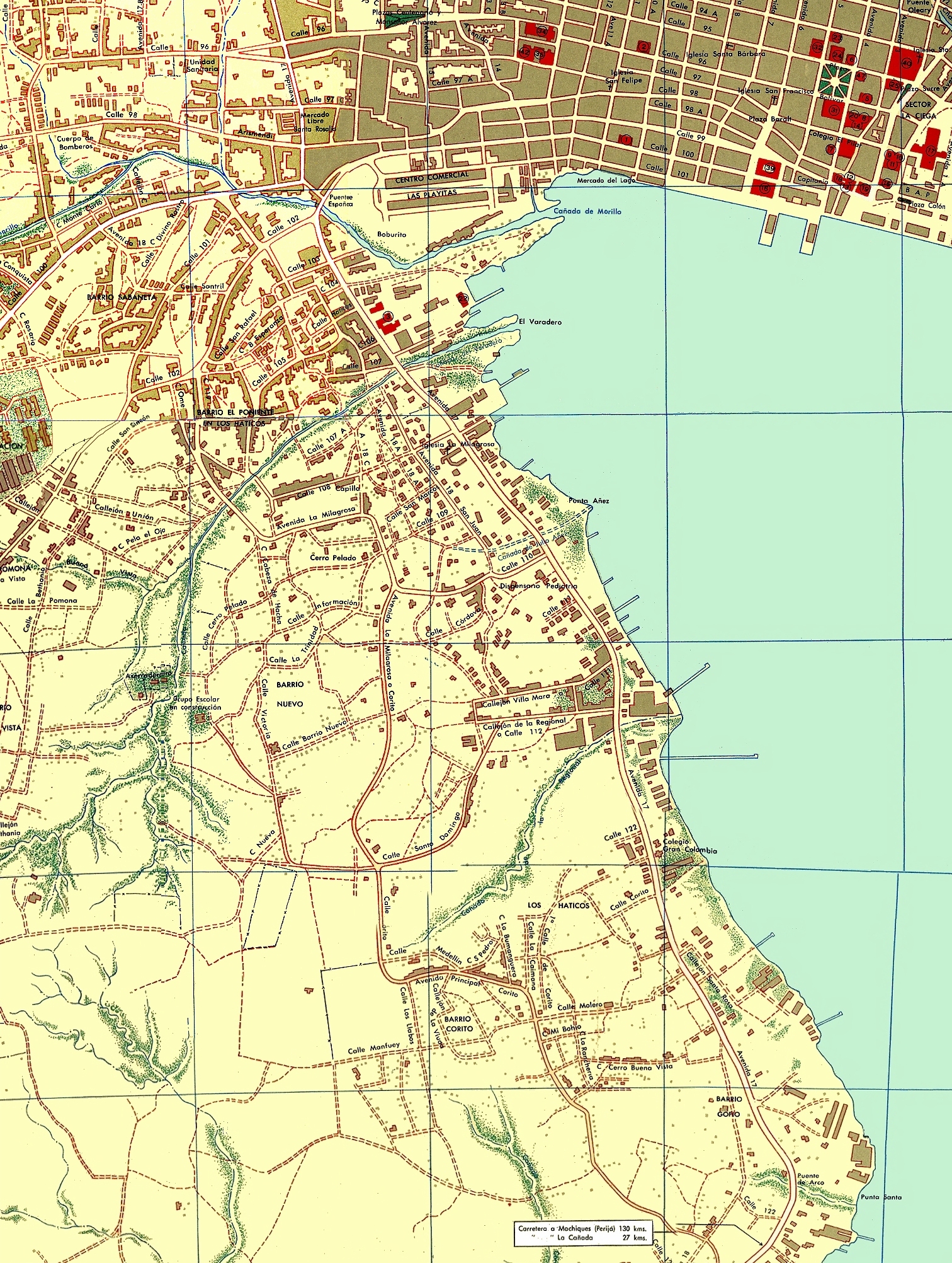
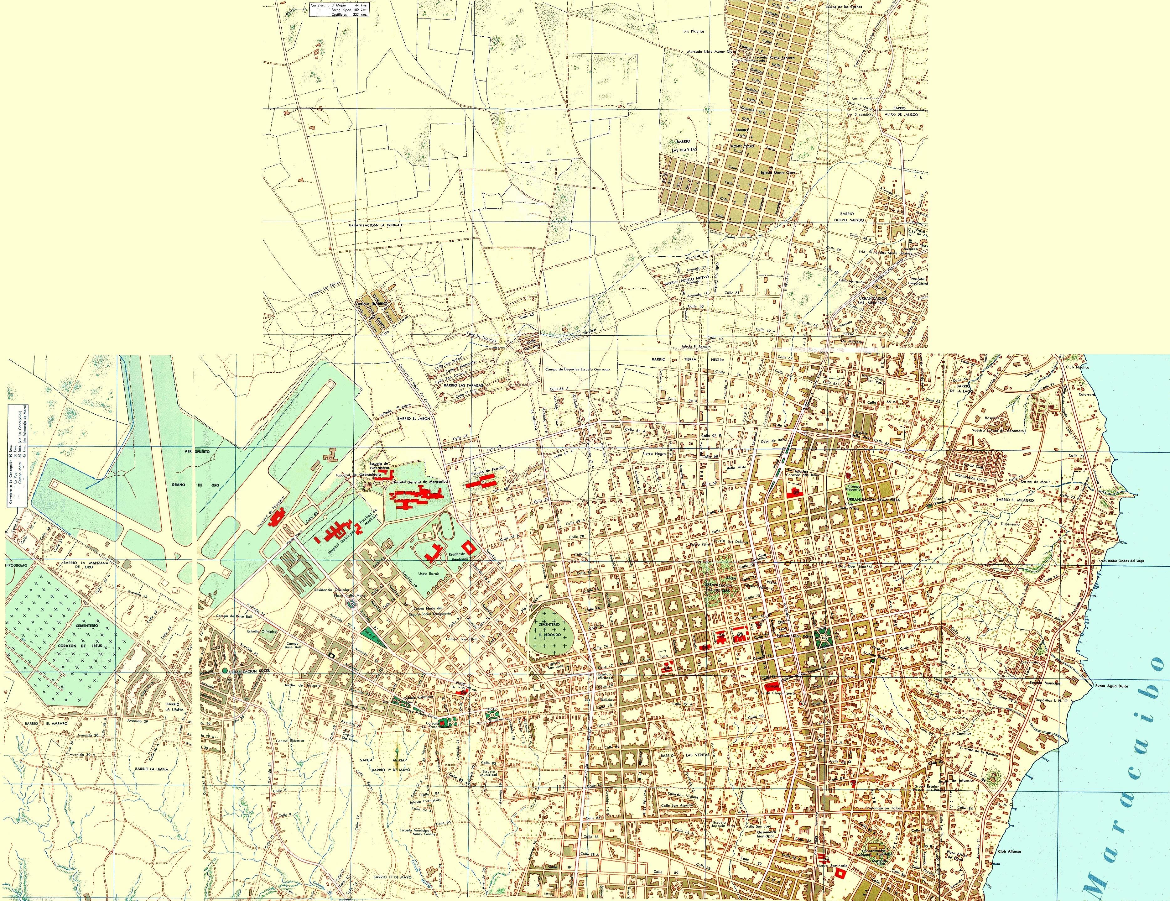
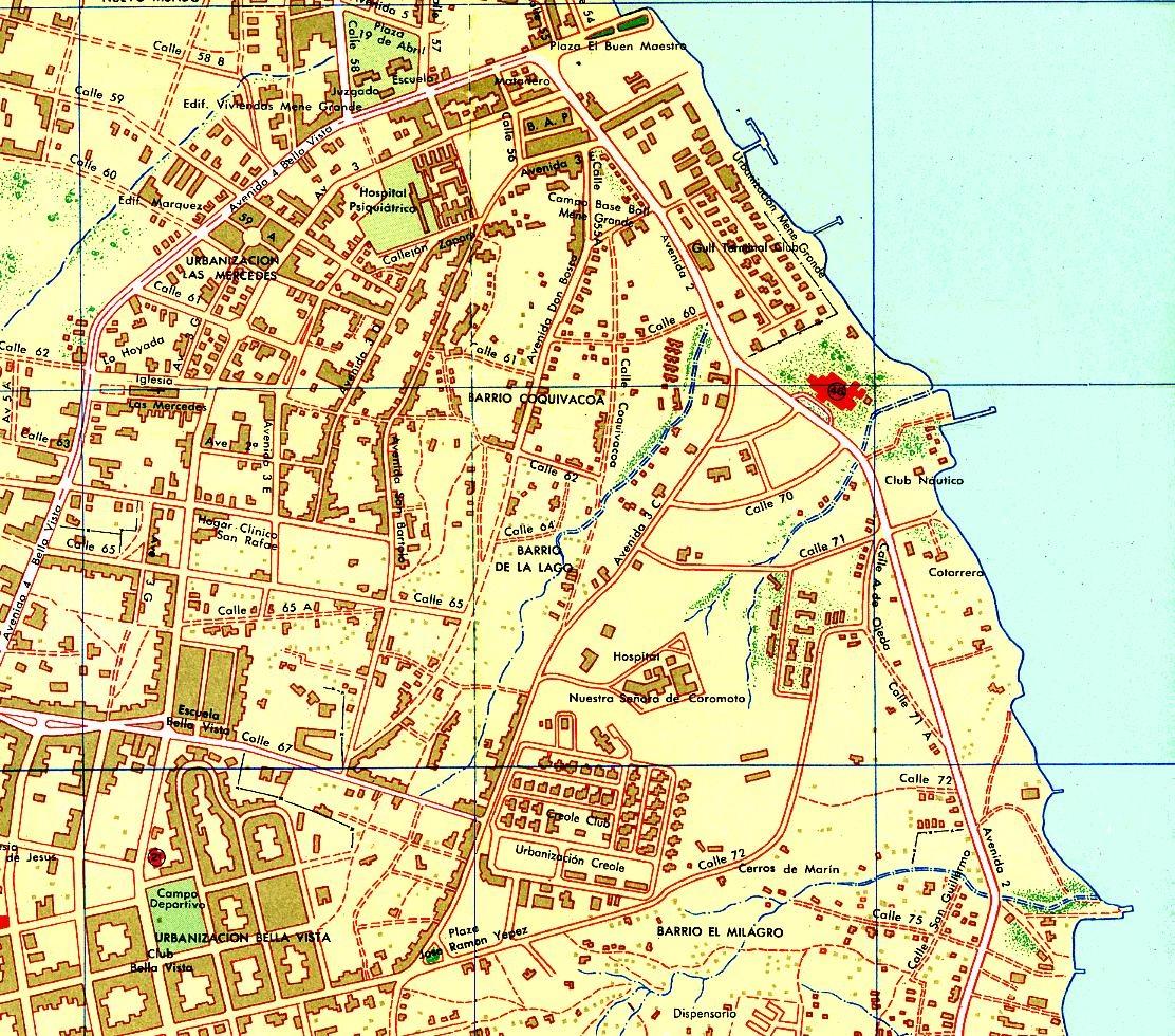
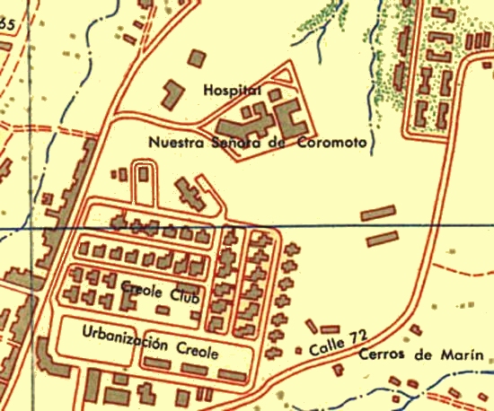
Portion of 1956 SHELL Map of
Maracaibo & Blow-Ups of Creole Club Area
These three images show portions of a map of Maracaibo
published by SHELL in 1956.
The first map shows a large swath of southern
Maracaibo including Los Haticos and the CREOLE Marine
Department offices.
The second map shows a large swath of northern
Maracaibo including the Creole Camp and the lake shore areas to
the south of the Club Náutico, and the old Grano de Oro
airport to the west.
The third map shows a closer view of the Creole
Camp area, and the areas around the Hotel del Lago, the
Mene Grande Camp next to the hotel with considerable detail, and the
Club Náutico.
The fourth shows the surprisingly detailed view of the
Creole Camp, down to the individual houses.
|
|
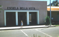
EBV & the Hotel del Lago
| |
 |
 |
 |
|
| |
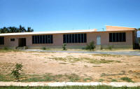
JULY 1956 - Front of
EBV main building, with Doug's sister, Kathy (“Chi-Chi”). |
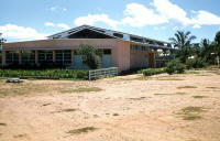
JULY 1956 - Rear of
EBV main building. The building is fairly new at this point, as
this back area, along with a rear classroom building, later
incorporated the open-air auditorium. Doug advises that he
believes the two-story classroom building was under construction
at this time. |
JULY 1956 - The gym
with the “shop” classroom on the end, taken before any asphalt
was laid down between this area and the front of the property. |
|
| |
 |
 |
 |
|
| |
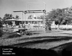
JULY 1956 - A
jungle-gym behind one of the classroom buildings. I can't quite
place which classroom building this was or where it was exactly
located on the school campus. |
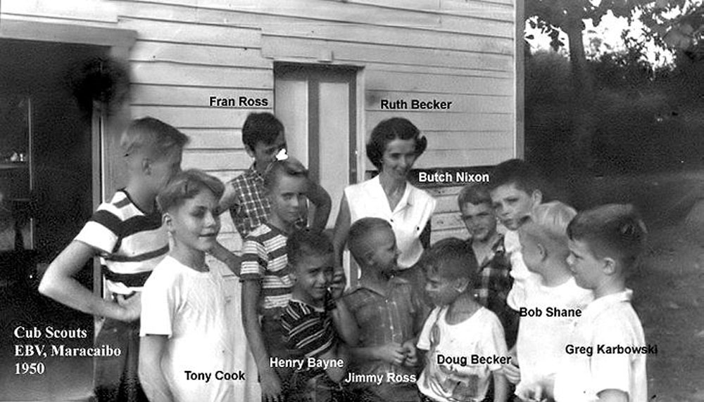
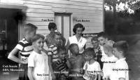
Cub Scouts, EBV,
1950 |
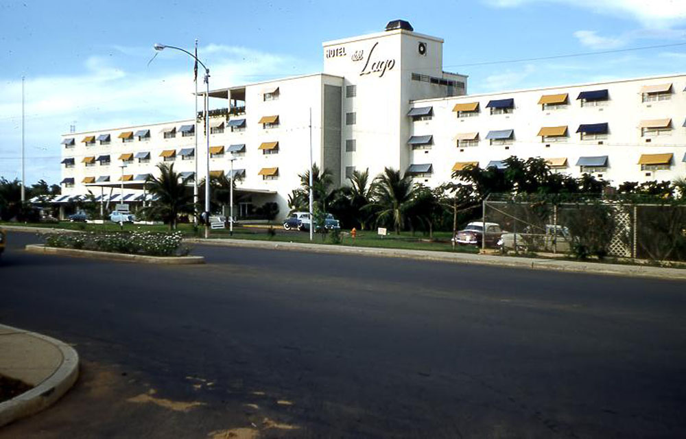
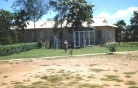
DECEMBER 1955 - The
Hotel del Lago when it was still fairly new. This shot was taken
before Avenida El Milagro, which runs in front of the hotel, was
widened with a larger center divider. |
|
| |
|
 |
|
|
| |
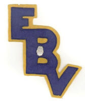
|
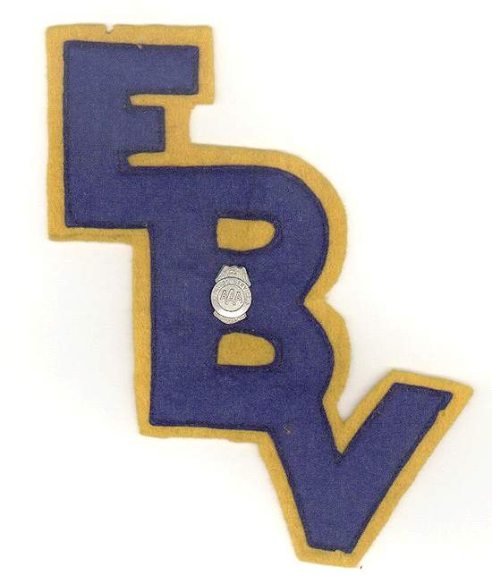
Doug writes, “I
don't remember why I got this other than it had something to do
with sports (I think). It would be nice to know if anyone else
remembers this item. The AAA pin in the middle indicated that I
was on the safety patrol.” |
|
|
|
|
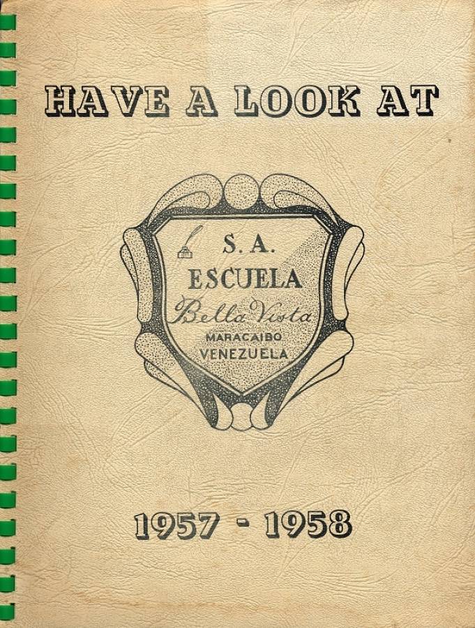
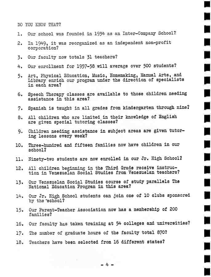
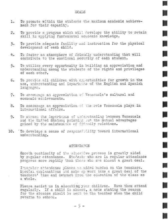
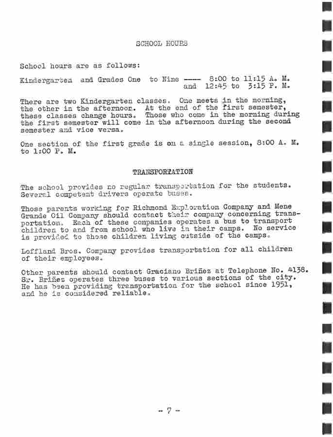
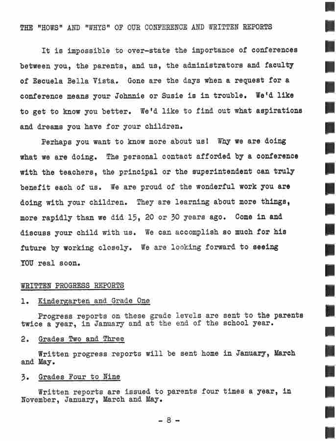
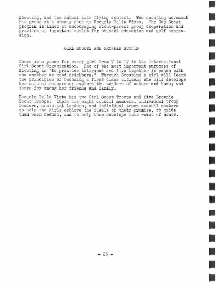
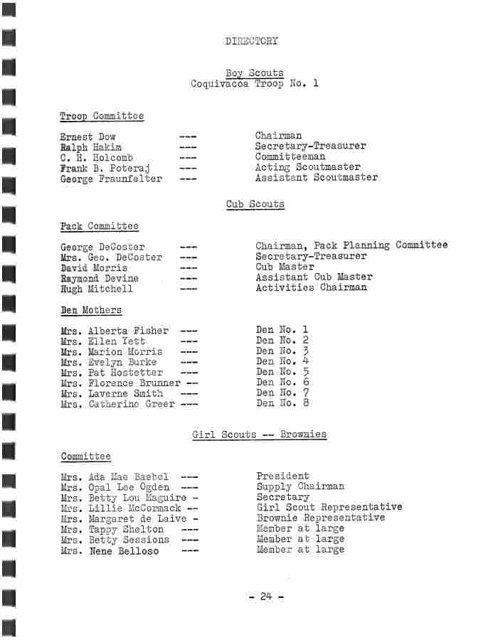
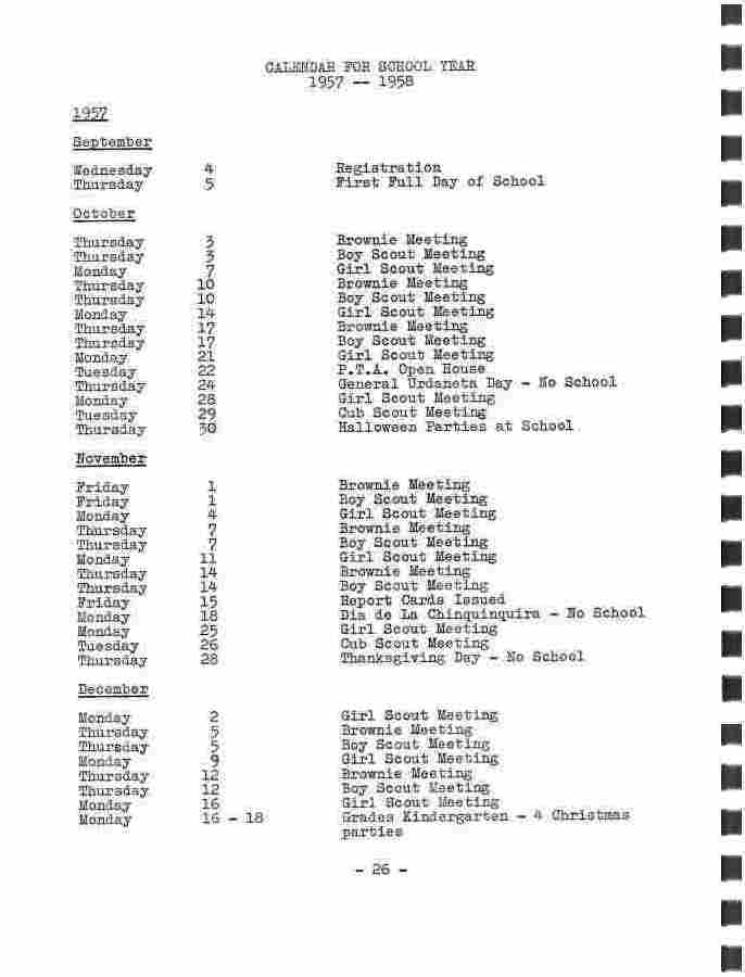
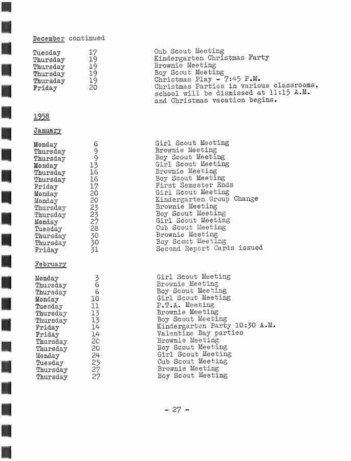
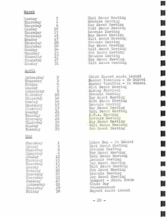
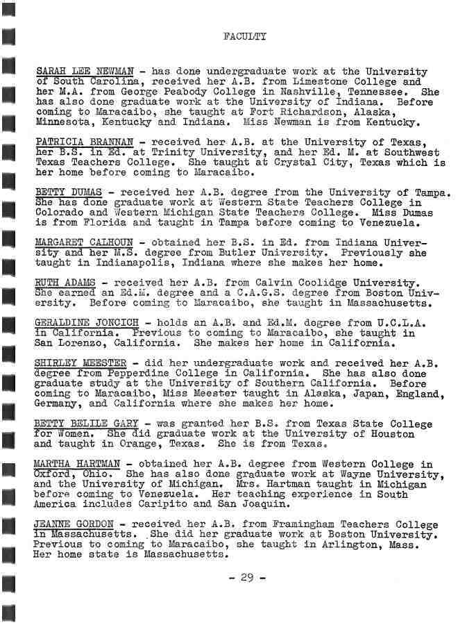
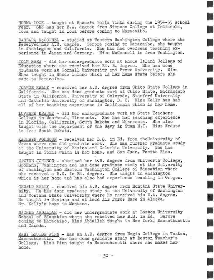
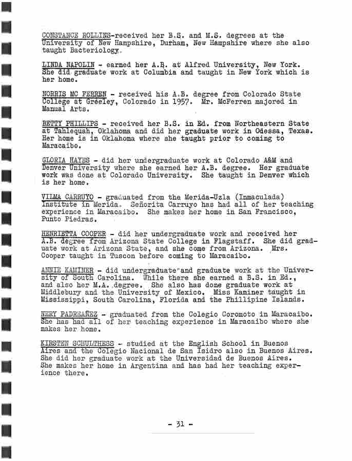
This EBV publication is entitled “Have A
Look At EBV”. All that Doug really knows about it is that it was a
publication that EBV passed out to the families of enrolled
students detailing interesting facts and information about the school as
it was during the 1957-1958 school year.
|
|